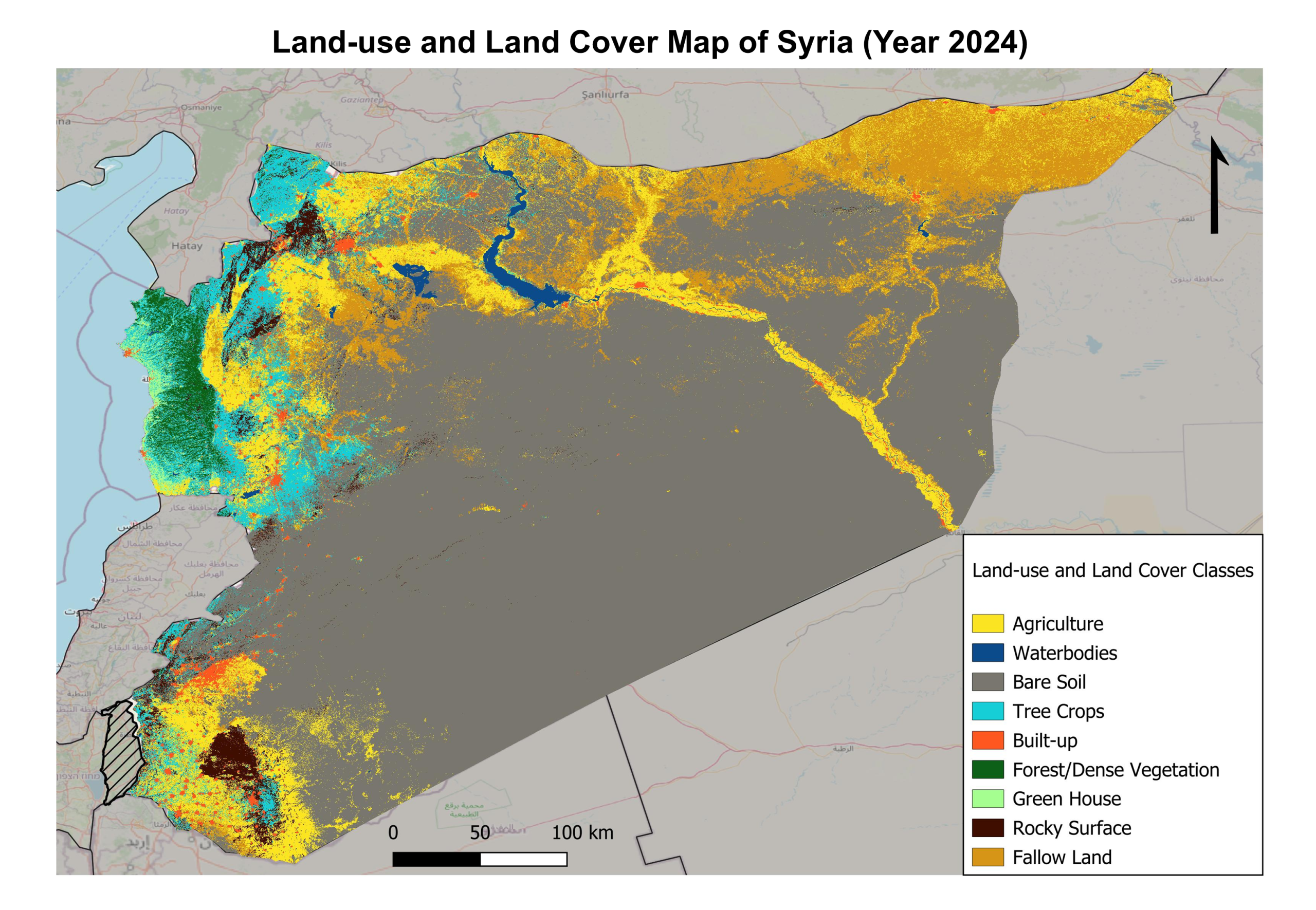
Here we share the maps, charts, and figures produced as part of the ECO-Syria Project. These visual materials are intended to support a deeper understanding of the complex interactions between the environment, conflict, and society in North and East Syria.
Licence: CC BY-ND
You are free to copy and distribute these materials in any medium or format, provided they remain unadapted and appropriate credit is given to the creator.